
Attractions
Taroko National Park
 Taroko National Park is one of the seven national parks in Taiwan. It spans the counties of Hualien, Taichung, and Nantou on the island of Taiwan. The name, Taroko, means the "magnificent and beautiful". Long ago a tribesman of the Truku aboriginal tribe saw the beauty of the azure Pacific when he walked out of the gorge. Astonished by the elegance of the scene, he cried: "Taroko!". And so it became the name of the place, in fashion not dissimilar to how the island, Formosa, got its name.
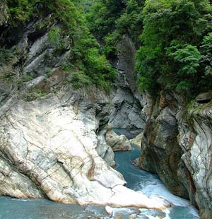
 Taroko National Park is famous for its spectacular mountains and marble canyons. Cliffs and canyons stretch along Liwu River. Four million years ago, the island of Taiwan was formed by the collision of plates. After millions of years of wind erosion, the marble rocks were exposed and cut by Liwu River, creating impressive grand canyons. From Chingshui to Nanhu Peak, the drop height is 3,742 meters. Such special geography has also bred special flora and fauna in this area.
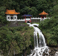 Waterfalls characterize Taroko National Park and the most famous ones are Baiyang Waterfall, Yintai Waterfall, Changchun Waterfall, and Lushui Waterfall. Swallow Grotto and Tunnel of Nine Turns are the most impressive natural scenes in Taroko and the canyons here are the narrowest.
Hualien Ocean Park
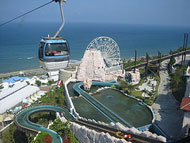 The 51-hectare Hualien Ocean Park is Taiwan's first theme park focusing on the marine ecology, and the only one that combines a theme park with a natural park and a five-star Victorian-style resort hotel.
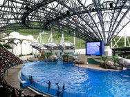 The main amusement zone includes the Brighton by the Sea, Crystal Castle, Discovery Island, Dolphin Lagoon, Harbour Square, Main Street, Mariner's Cove, and Underwater Kingdom. The cable car service is available so it is very convenient for elders and children. With all the fun facilities and shows, it is worth coming for many times.
Jichi Beach
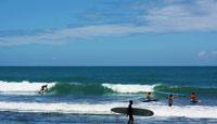 Jichi Beach is located at the 37-kilometer point along Highway 11. Differential erosion has formed this beautiful, curved bay edged by a sandy beach about 2.5 kilometers long. This beach, the closest to Hualien on the East Coast, is ideal for camping, swimming, playing in the water, or simply relaxing. The Bachi Observation Tower, located high on the mountainside at the northern end of the beach, is the perfect place for a bird's-eye view of the graceful curve of the bay and the waves breaking on the shore.
Rafting on Siuguluan River
 The Siuguluan River arises on the slopes of Mt Siuguluan and flows its way 103 kilometers until it empties into the Pacific Ocean on the East Coast. It is the longest river in eastern Taiwan, and has abundant water all year round. The river follows a winding path, flowing past Ruisui in the East Rift Valley and cutting a gorge through the Coastal Mountain Range on its way to the sea. This portion of the river is the most popular rafting course in Taiwan, with excitement- and thrill-seeking rafters being especially numerous from May to October.
Changhong Bridge
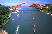 The Changhong Bridge, located at the mouth of the Siuguluan River, is the terminus for rafters. At the time of construction, in 1969, it was the longest single-span bridge in Taiwan. It is said to resemble a rainbow, hence its name "long rainbow" bridge. Below the bridge lies an area of strangely shaped limestone rocks. With a little imagination, the rocks can be said to resemble many different things.